
Nine Satellites from Würzburg provide initial Results
30.10.2026
TOM monitors volcanic eruptions, CuBy provides multispectral Earth observation imagery, and CloudCT is testing new methods for climate research. Nine satellites demonstrate what cooperative small-satellite systems are capable of.
On July 7th, 2026, nine Earth observation satellites developed and manufactured in Würzburg were launched into space. Just a few months later, the TOM, CuBy, and CloudCT Precursor missions are already delivering their first results. They demonstrate the potential of networked satellite systems for scientific research and practical applications.
Earth Observation Using Multiple Satellites
The three TOM satellites observed the volcanic eruption at Anak Krakatau in Indonesia. In the process, they captured an ash cloud that rose to an altitude of about 15 kilometers. This observation illustrates how satellite constellations can provide real-time information during natural disasters in the future.
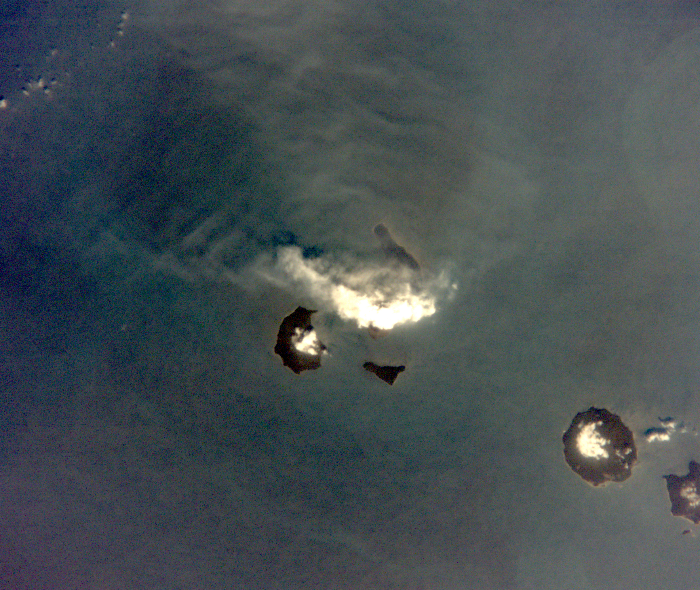
The TOM satellites were flying over the volcanic island of Anak Krakatau during the eruption and, from an ideal vantage point, observed the rising volcanic ash cloud, which was propelled 15 km into the air.
The five CuBy satellites have captured the first high-resolution multispectral images of the Earth’s surface. Bavaria’s Minister of Finance and Home Affairs, Albert Füracker, commented:
“Our five CuBy satellites, which are true high-tech ambassadors from Bavaria, have delivered high-resolution images of the Earth’s surface from space for the first time.”
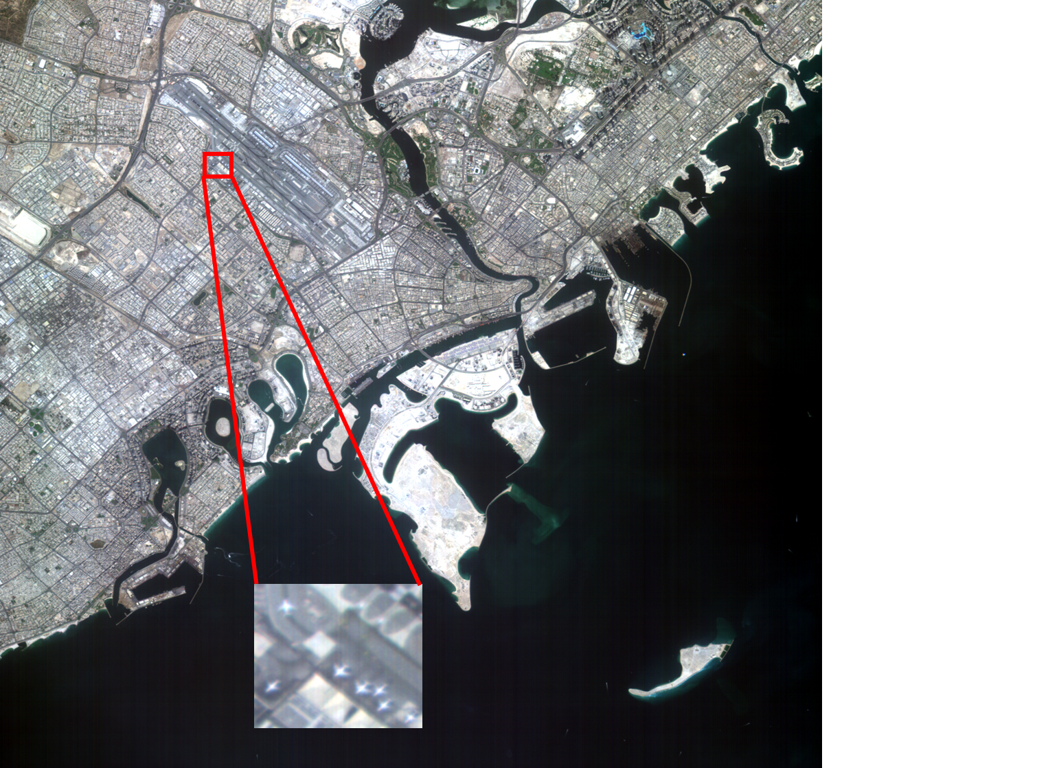
High-resolution image of Dubai, taken by the CuBy satellites. Airplanes taking off and waiting at the airport are clearly visible, as is the ship traffic in the harbor.
In the future, the mission is intended to provide data for cartography, agriculture, and forestry, as well as for nature conservation and disaster prevention in Bavaria.
New Insights into Clouds
The CloudCT Precursor has also provided its first scientifically promising data. Polarized light is used to study the properties of sunlight scattered by clouds. The results will help prepare for a satellite constellation that will use computed tomography techniques to observe clouds from multiple viewing angles in the future.
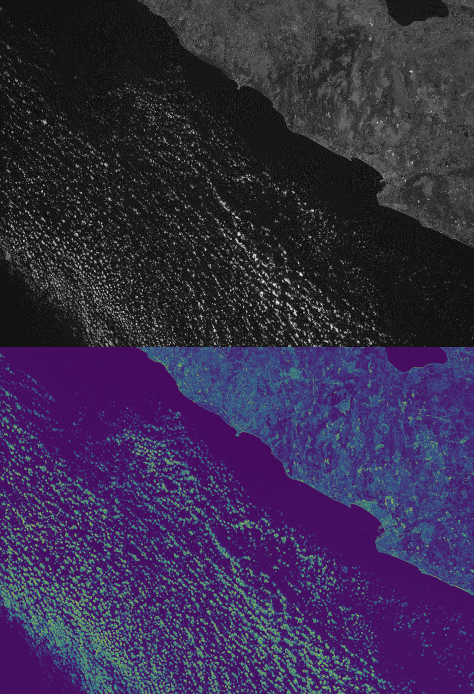
Clouds off the coast of Israel near Haifa. The top image shows light intensity, while the bottom image is a false-color representation of the polarized light component. The brighter the pixel, the higher the polarization of the light. This makes it easy to determine the composition of the clouds.
The goal is to better understand the properties of clouds and thereby establish a stronger scientific foundation for climate predictions.
From Satellite Construction to Coordinated Operations in Space
The results go beyond the successful launch of nine satellites. They demonstrate the ZfT’s capabilities across key aspects of a multi-satellite mission: from development and integration, through precise attitude control and coordinated satellite operations, to the acquisition of scientifically usable data.
In doing so, the ZfT builds on the experience gained from the NetSat mission, in which four small satellites were already used to study autonomous formation control.
The production of multiple satellites in a short period of time is also a key component of this development. At its research facility for microsatellites, the ZfT is investigating how automation, robotics, and standardized processes can make the manufacturing of future satellite systems more efficient. The current missions thus combine long-standing research with initial results in orbit and lay the groundwork for future networked satellite systems.
Further Information:
- TIM & TOM: Cooperating Satellites for Earth Observation
- CloudCT: Peering into the Interior of Clouds with Satellites
- Bavarian CuBy satellites
- Research Facility for Microsatellites
- More News from the ZfT
To view the full press release: Press Release October 26th, 2026
Magdalene-Schoch-Str. 5
97074 Würzburg - Germany
Daniel Eck (Geschäftsführer)
Telefon: +49 (0)931 615 633-10
Fax: +49 (0)931 615 633-11
E-Mail: info(at)telematik-zentrum.de
